


What does a 0.5% AEP flood really mean? A look at the new natural hazards policy, what it means for farmers, and why flood maps matter.
If you have been following council planning, property reports or even just the news lately, you may have noticed another acronym appearing – AEP. More particularly, it seems, 0.5% AEP.
AEP stands for Annual Exceedance Probability. A 1% AEP event has a one percent chance of being equalled or exceeded in any given year. That is where the familiar ‘one-in-100-year flood’ description comes from. A 0.5% AEP event has a half percent chance in any year, roughly a ‘one-in-200-year flood’.
Understanding risk
One-in-200-year flood events are increasingly cropping up in discussion, along with flood overlays, coastal inundation and a much greater focus on natural hazard risk.
Councils use different AEP levels for different purposes, and the government’s new national policy does not simply tell everyone to plan for a one-in-200-year flood. What it does do is to put much more emphasis on understanding risk.
The terminology can, however, be misleading. A one-in-200-year flood does not mean a flood that conveniently occurs every 200 years. If such a flood occurs today, there is still the same annual probability of one occurring next year. Two large flood events can happen relatively close together. Equally, a location may go for generations without one occurring.
Looking at the big picture of flooding
We also tend to picture flooding as a river coming over its banks after a big storm. In reality, inundation can come from intense rainfall, prolonged rain over a catchment, saturated ground, surface flooding, river flooding or coastal inundation. On the coast, tides, waves and storm surge can combine into a flooding event.
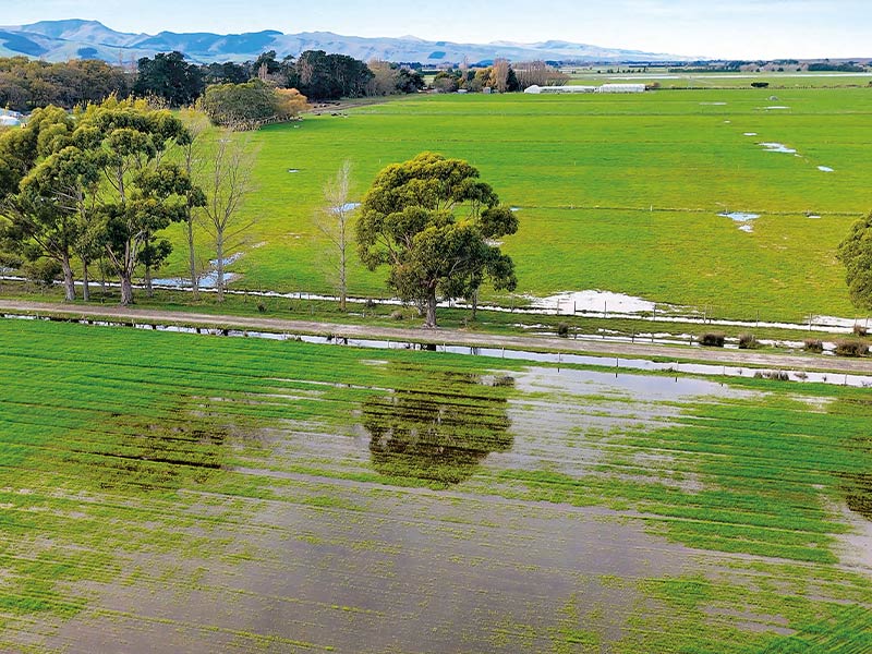
It isn’t simply a question of whether there is water on the ground either. Some 20cm or 30cm of relatively still water across a paddock is one thing. Water moving at speed through a workshop, house or set of yards is something else again. Depth matters, but so do velocity and duration, what is exposed to the water and what the flood waters themselves may be carrying, including sewage, forestry slash and other debris.
In built up urban areas the consequences can be greater again. There is simply more in the path of the water – homes, businesses, and schools, not to mention a lot more people. A relatively small increase in flood depth can become a much bigger problem when the water has nowhere obvious to go.
This is where some of the recent discussion around risk starts to make more sense.
National Policy Statement for Natural Hazards 2025
The National Policy Statement for Natural Hazards 2025 came into force on 15 January this year. It covers flooding, landslips, coastal erosion, coastal inundation, active faults, liquefaction and tsunami. Under it, decision-makers assess both the likelihood of a hazard and the consequences for people and property. The resulting risk is classed from low through to very high. Very high risk is to be avoided, while other risks are managed in proportion to their level.
The potential effects of climate change at least 100 years into the future also have to be considered.
For farmers there is an important qualification: Primary production is specifically excluded from the direct application of this National Policy Statement. It also does not override existing use rights. That doesn’t make hazard information on farms irrelevant. Councils retain powers to manage natural hazards and can take a more conservative approach or manage risks outside the direct scope of the national policy.
New Zealand Flood Map being developed
The government is also developing a New Zealand Flood Map, bringing council information together with national modelling. Existing council information is expected to be brought together for technical users during 2026, with the first-generation public map expected by May 2027.
One thing seems fairly certain. We are going to have a great deal more information about flood risk, not less.
A low paddock may grow tremendous grass. The fact it is susceptible to flooding does not suddenly make it bad farmland. But would you put the new workshop there?
What about the wintering shed, stockyards or loading ramp? Would you store expensive machinery there? Where are the electrics and fuel? If the water started rising, could you actually get the important gear out?
Maybe you would still build there, but knowing the risk beforehand gives you options. You might raise the floor level, rethink where the electrics go, make sure machinery can be shifted quickly or simply choose another part of the property. None of that is particularly radical. It is simply using the information available when making decisions about where to put valuable assets.
The same applies when buying land. A flood overlay should not automatically mean walking away, but you would want to know more. How much of the property is affected? What depth is expected? Is the water likely to sit or move? What is already built there and what might you want to build in another 10 or 20 years?
Then there are the questions around consenting, insurance, lending and, eventually, resale.
The world is changing. Climate risk is changing, but so is the information, modelling and rules we use to deal with it.
New Zealand has always been a wild country. Floods, slips, earthquakes and coastal hazards are hardly new discoveries. What is changing is our ability to identify where some of those risks lie before we put something valuable in their path.
A flood map does not tell you what to do with a property. It helps you understand the risk, ask the right questions and plan accordingly.
And next time someone at the barbecue starts talking about a 200-year flood, you can explain why it does not necessarily mean we have another 199 years to get ready for it.
John Sheddan is a director of Gore law firm, Sheddan Pritchard Law Ltd. He specialises in rural and commercial issues involving rural and residential property sales, business sales, leases and subdivisions. John also has a background in IT and a strong interest in technology and the legal issues it creates. Sheddan Pritchard Law Ltd is a member of NZ LAW Limited, an association of 62 independent law firms practising in more than 100 locations. Information given in this column should not be a substitute for legal advice.
Photos: Adobe Stock
